Overview
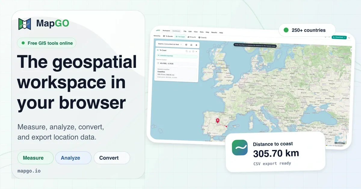
MapGO is a geospatial workspace engineered to operate entirely within a web browser, eliminating the need for traditional desktop GIS installations. It addresses the friction of performing routine location-based calculations—such as measuring distances to borders or coastlines, retrieving administrative hierarchies, and converting between coordinate formats—by providing a high-resolution dataset and an interactive map interface. The platform targets a broad audience, including data analysts, logistics professionals, real estate agents, and developers, who need swift geospatial answers without the learning curve or hardware demands of heavyweight software. In the crowded field of mapping tools, MapGO carves out a niche by focusing on specific, high-frequency tasks and making them accessible to non-specialists. Its value proposition is further strengthened by a free tier that requires no credit card, allowing users to test core functionality before committing financially. The tool is positioned as a complementary resource to full-featured GIS platforms, rather than a direct replacement, which is a pragmatic approach that acknowledges the depth of professional GIS software while offering a more approachable entry point for everyday geospatial queries.
Key Features
Location Hierarchy
MapGO can take any coordinate on the globe and return the corresponding administrative hierarchy, from country through region down to district or sub-region. This feature is powered by a comprehensive dataset that includes over 250 countries and territories and more than 90,000 sub-regions. The results are displayed instantly in the workspace, aiding users who need to categorize or enrich location data. For example, a user can click a point on the map and immediately see the country, region, and district names, which is invaluable for data normalization or field research.
Distance to Border
Calculating the distance from a point to the nearest national or regional boundary is a core functionality. MapGO uses its boundary shapefiles to compute the shortest straight-line distance in kilometers. This is particularly useful for supply chain planning, where warehouses may need to be strategically placed relative to borders, or for insurance companies assessing risk zones.
Distance to Coastline
Complementing the border distance, this feature measures how far a point is from the nearest coastline. It relies on precise coastline shapefiles that offer high resolution even for complex shorelines. Coastal proximity is a critical metric for real estate valuation, environmental studies, and tourism planning.
Point-to-Point Distance
This tool calculates the great-circle distance between two arbitrary locations on the map. The calculation uses the haversine formula, providing accurate geodesic measurements over short or long distances. Users can click two points or input coordinates, making it simple to estimate travel distances or validate logistical routes without external calculators.
GPS Converter
MapGO includes a coordinate converter that supports decimal degrees (DD), degrees-minutes-seconds (DMS), and degrees-minutes-minutes (DMM) formats. This utility eliminates the need to write custom conversion scripts when working with GPS data from various devices or software. The converter is integrated into the workspace, ensuring a seamless workflow when transforming coordinates for mapping or analysis.
Measure & Draw Toolkit
The workspace provides on-map measurement tools for distance, area, radius, and bearing. Users can draw polygons or circles and see the relevant measurements update live. Additionally, the buffer tool allows the creation of buffer zones around features, and annotation capabilities enable custom shapes to be added for presentations. This toolkit is lightweight yet robust enough for quick spatial analysis, making it suitable for team discussions or initial site assessments.
File Conversion & Bulk CSV Processing
MapGO can convert files between GeoJSON, KML, GPX, Shapefile, and CSV formats. This addresses a common interoperability pain point for GIS users who receive data in one format but need it in another. Moreover, the convert tool supports bulk CSV upload, allowing users to process thousands of latitude/longitude rows in a single job, enriching an entire dataset with hierarchy or distance information. This turns a tedious, repetitive process into a one-click operation.
Developer API
MapGO exposes its geospatial intelligence through a REST API available on RapidAPI. The API endpoints mirror the workspace features, enabling developers to integrate location lookups, distance calculations, and hierarchy retrieval into their own applications. The example snippet on the landing page demonstrates how a simple fetch request can return a comprehensive response containing hierarchy, border distance, and coastline distance, all in JSON format. This gives the platform a dual nature as both a user-facing tool and a backend service, broadening its appeal to a technical audience.
How It Works
The typical user journey begins by navigating to the MapGO Workspace, which loads an interactive map in the browser. The interface is clean, with a sidebar containing tool options and a central map canvas. Users can either click directly on the map to drop a point or input latitude and longitude coordinates manually. Once a location is set, they can choose from tools such as Location Hierarchy, Distance to Border, or Distance to Coast. The system processes the request against its underlying dataset and displays the result in a panel, often with additional metadata like the name of the nearest border or coastline segment.
For measurement tasks, the workspace switches to a drawing mode where users click to create lines, polygons, or circles. The measurements appear in real time as the user drags points, and annotations can be added for clarity. For file conversion, users navigate to the dedicated Convert page, upload a file, select the target format, and click convert. The processed file is generated and made available for download. Bulk CSV processing follows a similar pattern: upload a CSV with coordinate columns, select the enrichment options (e.g., add country, distance to coast), and submit the job. The service processes each row and returns a downloadable enriched file.
The developer API follows a standard REST pattern. After obtaining an API key from RapidAPI, a developer can make requests to endpoints like full-response-from-coordinates, passing source latitude and longitude parameters. The response is a structured JSON object containing details about the location's hierarchy, distance to border, and distance to coastline. This is designed to be straightforward enough for a frontend developer to integrate within minutes, as shown in the provided JavaScript example.
Use Cases
Logistics and Fleet Management
A regional delivery company can use MapGO to pre-screen potential distribution centers by measuring their distance to international borders or coastlines, which may affect customs clearance times or import/export costs. By bulk-processing a list of candidate coordinates, the company can quickly rank locations based on proximity constraints, saving hours of manual research.
Real Estate and Property Analysis
Real estate analysts can leverage the distance-to-coastline feature to appraise coastal properties accurately. Instead of manually measuring from maps, they can drop points on properties and instantly obtain distance readings. This data can be incorporated into valuation models or marketing materials, providing a quantitative edge.
Environmental and Urban Planning
Researchers studying flood risk or coastal erosion can use MapGO to calculate distances from affected points to the shoreline, enabling them to categorize vulnerabilities. The mapping tools allow them to draw buffer zones and assess the percentage of an area within a certain distance, which is essential for creating hazard assessments.
Data Enrichment and E-commerce
An e-commerce platform that collects customer addresses can use the bulk CSV upload to add country and region classifications to each entry. By uploading a CSV of GPS coordinates, the platform can automatically append administrative hierarchy details, improving targeting and regional reporting without writing custom geocoding logic.
Application Development and Startups
Developers building location-aware apps can integrate MapGO's API to validate user-entered addresses or determine if a point lies within a certain coastal region. The free tier of the API is sufficient for small projects, and the straightforward documentation accelerates time-to-market. Startups with limited resources benefit from not having to license or host their own geospatial dataset.
Pricing & Value
MapGO employs a freemium model. Without an account, users receive 5 lookups per day, which serves as a demonstration of the tool's capabilities. Creating a free account increases the limit to 10 lookups per day, still without any credit card requirement. For users who need higher quotas, the pricing page outlines paid plans that presumably scale with the number of lookups or feature access. The pricing structure is common in the geospatial API space, where costs are tied to usage volume. For occasional users—such as a developer testing the API or a real estate agent needing a few distance checks—the free tier is generous. However, power users who process thousands of coordinates daily will likely need a paid plan, and the cost may become comparable to other specialized GIS data providers. The value proposition is strong for those who need specific, lightweight geospatial functionality without the overhead of enterprise GIS licenses. The inclusion of a developer API with a free tier is a notable advantage, making MapGO a cost-effective building block for side projects and early-stage startups.
Final Verdict
MapGO successfully delivers a polished, browser-based geospatial workspace that prioritizes speed and simplicity. Its high-resolution dataset, coupled with a user-friendly interface, makes it an excellent choice for professionals who require occasional geospatial measurements or file conversions without installing complex software. The free tier is a great starting point, and the API extends the tool's utility far beyond the interactive map. That said, the daily lookup limitations could frustrate heavy users, and the lack of offline functionality may be a drawback for fieldwork scenarios. Additionally, while the file conversion feature is valuable, the platform does not offer the deep spatial analysis capabilities found in desktop GIS applications. For users whose needs align with its feature set, MapGO offers a compelling balance of convenience, price, and functionality. It is particularly recommended for logistics analysts, real estate professionals, and developers seeking to enrich applications with quick geospatial data. Those requiring comprehensive geoprocessing would still need a more robust solution, but for many everyday tasks, MapGO stands out as a fast and reliable web-based tool.